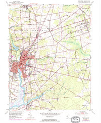
1953 Map of Bridgeton
USGS Topo · Published 1972About this map
The Cohansey River anchors the industrial and civic heart of Bridgeton, flowing past the Courthouse and City Park during a period of significant mid-century expansion. This 1953 landscape, updated with 1972 revisions shown in purple, reveals the transition from a traditional river-and-rail economy toward suburban growth and intensified food processing. To the north, Seabrook represents a massive center of agricultural industry, supported by a dense network of smaller settlements like Finley and Woodruff.
Find a feature on this map
85 named features on this map. Tap any name to fly to it.
Don’t see what you’re looking for? This feature index may not catch every label — zoom into the map to look around manually.
Map Details
Editions of this 1953 Bridgeton Map
4 editions found
Other maps of this area

1890 · Salem
USGS Topo · 1:62,500

1890 · Bay Side
USGS Topo · 1:62,500

1890 · Bridgeton
USGS Topo · 1:62,500

1890 · Glassboro
USGS Topo · 1:62,500

1894 · Bay Side
USGS Topo · 1:62,500

1894 · Bridgeton
USGS Topo · 1:62,500

1898 · Salem
USGS Topo · 1:62,500

1898 · Glassboro
USGS Topo · 1:62,500

1899 · Vineland
USGS Topo · 1:125,000

1901 · Camden
USGS Topo · 1:125,000