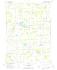
1967 Map of Bridgewater
USGS Topo · Published 1977About this map
The unincorporated settlement of Bridgewater and the rural corners of Rogers Corner anchor this agricultural landscape in the mid-1960s. The terrain is defined by a series of glacial water bodies, including Pleasant Lake, Columbia Lake, Silver Lake, and Schasser Lake, which are linked by small drainage networks and the winding River Raisin to the southwest. The presence of numerous family-named roads such as Loeffler Road, Haab Road, and Diuble Road reflects a deep-rooted farming community. Cultural centers are concentrated around local parishes and schools, notably the Pleasant Lake Sch, St Thomas Ch, and Bethel Ch. This 1967 survey also documents the industrial activities of the era, recording an Old Railroad Grade and numerous Gravel Pits that suggest the extractive land use typical of this portion of Washtenaw County.
Find a feature on this map
61 named features on this map. Tap any name to fly to it.
Don’t see what you’re looking for? This feature index may not catch every label — zoom into the map to look around manually.
Map Details
Editions of this 1967 Bridgewater Map
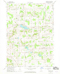
2 editions found
Other maps of this area

1902 · Dexter
USGS Topo · 1:62,500

1904 · Ann Arbor
USGS Topo · 1:125,000

1906 · Dexter
USGS Topo · 1:62,500

1906 · Saline
USGS Topo · 1:62,500

1908 · Ann Arbor
USGS Topo · 1:125,000

1919 · Stockbridge
USGS Topo · 1:62,500

1922 · Stockbridge
USGS Topo · 1:62,500

1942 · Stockbridge
USGS Topo · 1:62,500

1948 · Manchester
USGS Topo · 1:62,500

1949 · Manchester
USGS Topo · 1:62,500
Featured Places
- Lodi Township, MI
- Saline Township, MI
- Bridgewater, Bridgewater Township
- Bridgewater Township, MI
- Freedom Township, MI