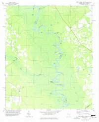
1978 Map of Brier Creek Landing
USGS Topo · Published 1978About this map
The Savannah River winds in tight, serpentine oxbows through the swampy lowlands of the Georgia-South Carolina border, defining the boundary between Screven and Allendale counties. This mid-1970s landscape is characterized by a series of river access points, including Red Bluff Landing, Cohens Bluff Landing, and the namesake Brier Creek Landing. The dense wetlands are interspersed with numerous lakes and sloughs such as Johnson Lake, Barnes Lake, and Conyers Lake, reflecting the shifting nature of the river's course over time.
Find a feature on this map
40 named features on this map. Tap any name to fly to it.
Don’t see what you’re looking for? This feature index may not catch every label — zoom into the map to look around manually.
Map Details
Editions of this 1978 Brier Creek Landing Map
This is the sole edition of this map. No revisions or reprints were ever made.
Other maps of this area

1918 · Oliver
USGS Topo · 1:62,500

1919 · Shirley
USGS Topo · 1:62,500

1920 · Hilltonia
USGS Topo · 1:62,500

1920 · Oliver
USGS Topo · 1:62,500

1920 · Peeples
USGS Topo · 1:62,500

1943 · Hilltonia
USGS Topo · 1:62,500

1943 · Peeples
USGS Topo · 1:62,500

1943 · Shirley
USGS Topo · 1:62,500

1943 · Millen
USGS Topo · 1:125,000

1943 · Oliver
USGS Topo · 1:62,500
Featured Places
- Brier Creek Landing, GA
- Red Bluff Landing, SC
- Hampton County, SC
- Screven County, GA
- Allendale County, SC