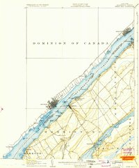
1906 Map of Brier Hill
USGS Topo · Published 1932About this map
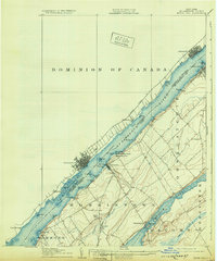
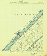
The St Lawrence River serves as the dominant corridor of this 1904 survey, illustrating the critical transportation and boundary relationship between New York and the Dominion of Canada. The maritime and rail economy of the early 20th century is evident in the alignment of the New York Central railroad along the southern shore, serving settlements like Morristown and Brier Hill Sta. Across the water, the Grand Trunk Route mirrors this development on the Canadian side, connecting Brockville and Prescott. Further inland, the landscape transitions toward the expansive Black Lake, where the Narrows and the community of Edwardsville mark a more interior, rural character. The map details numerous river features such as Morristown Bay, Lily Bay, and Macnair Is, which defined the local geography before mid-century modernization altered the river's shoreline and navigation patterns.
Find a feature on this map
50 named features on this map. Tap any name to fly to it.
Don’t see what you’re looking for? This feature index may not catch every label — zoom into the map to look around manually.
Map Details
Editions of this 1906 Brier Hill Map
7 editions found
Other maps of this area

1903 · Alexandria Bay
USGS Topo · 1:62,500

1904 · Lisbon
USGS Topo · 1:48,000

1904 · Ogdensburg
USGS Topo · 1:62,500

1905 · Ogdensburg
USGS Topo · 1:62,500

1906 · Brier Hill
USGS Topo · 1:62,500

1906 · Red Mills
USGS Topo · 1:62,500

1912 · Hammond
USGS Topo · 1:62,500

1915 · Gouverneur
USGS Topo · 1:62,500

1937 · Gouverneur
USGS Topo · 1:62,500

1942 · Morristown
USGS Topo · 1:24,000