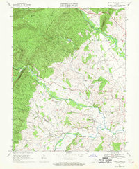
1967 Map of Briery Branch
USGS Topo · Published 1970About this map
George Washington National Forest dominates the western half of this landscape, where high ridges like Back Mountain and Prospect Knob rise sharply above the Shenandoah Valley floor. The transition from the steep, timbered slopes of Fox Ridge to the fertile agricultural plains is marked by a series of small settlements and crossroad communities. Rawley Springs sits at the northern edge where Dry River emerges from the mountains, while further south, Sangerville and Ottobine serve as focal points for the farming district.
Find a feature on this map
44 named features on this map. Tap any name to fly to it.
Don’t see what you’re looking for? This feature index may not catch every label — zoom into the map to look around manually.
Map Details
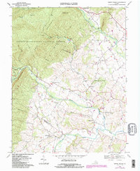
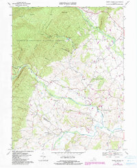
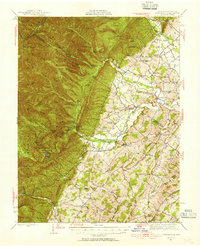
Editions of this 1967 Briery Branch Map
3 editions found
Other maps of this area

1892 · Franklin
USGS Topo · 1:125,000

1892 · Woodstock
USGS Topo · 1:125,000

1892 · Harrisonburg
USGS Topo · 1:125,000

1894 · Staunton
USGS Topo · 1:125,000

1896 · Franklin
USGS Topo · 1:125,000

1922 · Fort Seybert
USGS Topo · 1:48,000

1924 · Fort Seybert
USGS Topo · 1:62,500

1941 · Harrisonburg
USGS Topo · 1:62,500

1943 · Harrisonburg
USGS Topo · 1:62,500
1944 · Parnassus
USGS Topo · 1:62,500