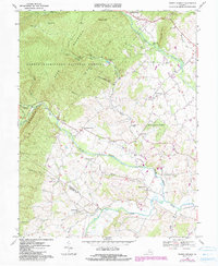
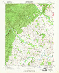
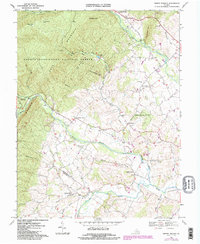
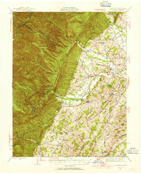
1967 Map of Briery Branch
USGS Topo · Published 1984About this map
Rawley Springs and Sangerville anchor a landscape defined by the transition from the forested heights of the George Washington National Forest to the productive agricultural basins of the North River and Dry River. This 1967 survey, updated with 1980s photographic revisions, reveals a pattern of rural community life centered around local institutions such as the Ottobine Sch and numerous country churches, including Spring Creek Ch and Beaver Creek Ch. The terrain is marked by significant natural barriers like Back Mountain and Narrow Back, while an Old Railroad Grade near the Mossy Creek confluence speaks to former industrial transport routes. The boundary between Rockingham Co and Augusta Co cuts through the southern portion of the quadrangle, illustrating how these mountain-to-river corridors historically influenced county lines and settlement clusters like Lilly and Clover Hill.
Find a feature on this map
40 named features on this map. Tap any name to fly to it.
Don’t see what you’re looking for? This feature index may not catch every label — zoom into the map to look around manually.
Map Details
Editions of this 1967 Briery Branch Map
3 editions found
Other maps of this area

1892 · Franklin
USGS Topo · 1:125,000

1892 · Woodstock
USGS Topo · 1:125,000

1892 · Harrisonburg
USGS Topo · 1:125,000

1894 · Staunton
USGS Topo · 1:125,000

1896 · Franklin
USGS Topo · 1:125,000

1922 · Fort Seybert
USGS Topo · 1:48,000

1924 · Fort Seybert
USGS Topo · 1:62,500

1941 · Harrisonburg
USGS Topo · 1:62,500

1943 · Harrisonburg
USGS Topo · 1:62,500
1944 · Parnassus
USGS Topo · 1:62,500