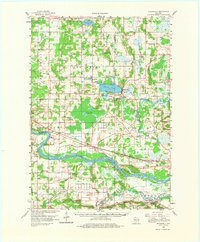
1958 Map of Briggsville
USGS Topo · Published 1981About this map
The Wisconsin River and the Baraboo River define the lower half of this central Wisconsin landscape, where the Chicago Milwaukee St Paul and Pacific railroad tracks follow the river's path through Lewiston. In the northern sections, the village of Briggsville sits at the eastern end of Mason Lake, serving as a focal point between the marshy drainages of Neenah Creek and Widow Creek.
Find a feature on this map
59 named features on this map. Tap any name to fly to it.
Don’t see what you’re looking for? This feature index may not catch every label — zoom into the map to look around manually.
Map Details
Editions of this 1958 Briggsville Map
3 editions found
Other maps of this area

1895 · Baraboo
USGS Topo · 1:62,500

1901 · Denzer
USGS Topo · 1:62,500

1901 · Poynette
USGS Topo · 1:62,500

1901 · The Dells
USGS Topo · 1:62,500

1902 · Portage
USGS Topo · 1:62,500

1902 · Briggsville
USGS Topo · 1:62,500

1908 · Baraboo
USGS Topo · 1:62,500

1957 · Wisconsin Dells
USGS Topo · 1:62,500

1957 · Madison
USGS Topo · 1:250,000

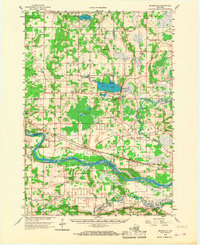
1958 · Briggsville
USGS Topo · 1:62,500