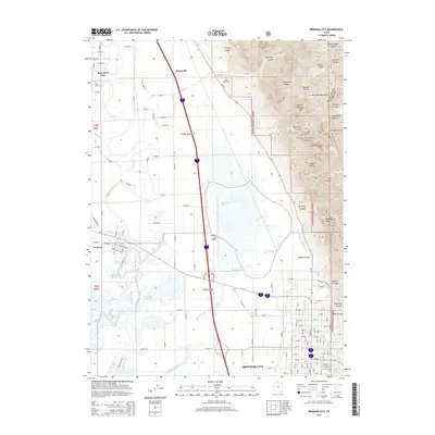
2014 Map of Brigham City
USGS Topo · Published 2014About this map
Brigham City serves as the focal point for this 2014 survey, where the urban grid meets the dramatic rise of the Wasatch Range and Wellsville Mountains. The landscape transitions from the developed corridors of the county seat to the sprawling wetlands and braided channels of the Bear River, featuring unique hydrological landmarks like Horseshoe Sloughs, Dead River, and Black Slough. These water features underscore the irrigation and drainage complexity required by the region's agricultural history, further evidenced by the Box Elder Canal and Perry Canal. To the north, the smaller settlements of Honeyville and Bear River City are documented, alongside rural landmarks such as the Harper Ward Cem and the Brigham City Airport. The eastern edge of the map is defined by deep canyons, including Cataract Canyon and Antimony Canyon, which carve through the Cache National Forest towards prominent heights like Mitton Peak.
Find a feature on this map
141 named features on this map. Tap any name to fly to it.
Don’t see what you’re looking for? This feature index may not catch every label — zoom into the map to look around manually.
Map Details
Editions of this 2014 Brigham City Map
This is the sole edition of this map. No revisions or reprints were ever made.
Other maps of this area

1914 · Logan
USGS Topo · 1:125,000

1916 · Logan
USGS Topo · 1:125,000

1954 · Whistler Canal
USGS Topo · 1:24,000

1954 · Ogden
USGS Topo · 1:250,000

1954 · Brigham City
USGS Topo · 1:250,000

1955 · Mantua
USGS Topo · 1:24,000

1955 · Bear River City
USGS Topo · 1:24,000

1955 · Willard
USGS Topo · 1:24,000

1955 · Mount Pisgah
USGS Topo · 1:24,000

1955 · Brigham City
USGS Topo · 1:24,000