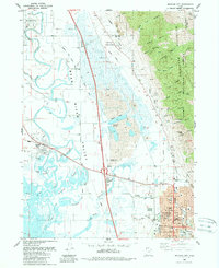
1988 Map of Brigham City
USGS Topo · Published 1988About this map
The Wellsville Mountains form a dramatic eastern boundary for this late-1980s landscape, which centers on the busy street grid of Brigham City. The town’s civic footprint is clearly defined by landmarks such as the Courthouse, City Hall, and Box Elder High Sch, with the local heritage preserved at Memorial Park (Cem) and Rees Pioneer Park. To the west, the Bear River Valley unfolds with a complex network of irrigation and drainage, including the Hammond Canal and the meandering Bear River. Traces of the region's transport and industrial history are visible in the Old Railroad Grade and the Brigham City Municipal Airport. In the canyon-cut mountains, small-scale extraction is documented through the Baker Mine and various Prospect Mines scattered near Donation Hollow, while the northern flats preserve the site of Calls Fort and its Historical Monument.
Find a feature on this map
77 named features on this map. Tap any name to fly to it.
Don’t see what you’re looking for? This feature index may not catch every label — zoom into the map to look around manually.
Map Details
Editions of this 1988 Brigham City Map
This is the sole edition of this map. No revisions or reprints were ever made.
Other maps of this area

1914 · Logan
USGS Topo · 1:125,000

1916 · Logan
USGS Topo · 1:125,000

1954 · Whistler Canal
USGS Topo · 1:24,000

1954 · Ogden
USGS Topo · 1:250,000

1954 · Brigham City
USGS Topo · 1:250,000

1955 · Mantua
USGS Topo · 1:24,000

1955 · Bear River City
USGS Topo · 1:24,000

1955 · Willard
USGS Topo · 1:24,000

1955 · Mount Pisgah
USGS Topo · 1:24,000

1955 · Brigham City
USGS Topo · 1:24,000