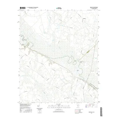
2017 Map of Brighton
USGS Topo · Published 2017About this map
The Savannah River meanders through this borderland between South Carolina and Georgia, defining a landscape of wetlands and riverine reaches. Along its eastern banks, notable geographic landmarks like Stokes Bluff and Palichucola Bluff rise above the surrounding swampy bottomlands, which are punctuated by isolated water bodies including Fowl Craw Lake, James Lake, and Webster Lake. The small community of Brighton sits in the northeast, connected to the river corridor by a network of historic routes such as Augusta Stagecoach Rd and Clyo Rd.
Find a feature on this map
64 named features on this map. Tap any name to fly to it.
Don’t see what you’re looking for? This feature index may not catch every label — zoom into the map to look around manually.
Map Details
Editions of this 2017 Brighton Map
This is the sole edition of this map. No revisions or reprints were ever made.
Other maps of this area

1919 · Pineland
USGS Topo · 1:62,500

1919 · Shirley
USGS Topo · 1:62,500

1919 · Egypt
USGS Topo · 1:62,500

1920 · Hardeeville
USGS Topo · 1:62,500

1939 · Egypt
USGS Topo · 1:62,500

1943 · Pineland
USGS Topo · 1:62,500

1943 · Hardeeville
USGS Topo · 1:62,500

1943 · Egypt
USGS Topo · 1:62,500

1943 · Shirley
USGS Topo · 1:62,500

1947 · Savannah
USGS Topo · 1:250,000