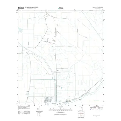
2012 Map of Brighton SE
USGS Topo · Published 2012About this map
Sarasota Colony and Big Bear Beach sit at the southern edge of this landscape, where the land meets the massive expanse of Lake Okeechobee. This area of Glades County is defined by a rigorous grid of water management and access roads, centered on the Harney Pond Canal and its namesake Harney Pond Canal Bridge. The map reveals a specialized infrastructure of Bureau of Indian Affairs routes, including BIA Hwy 283 and BIA Hwy 284, which provide access to interior points like Knotts Lndg. This network of roads, such as Frank Shore Rd and N Tucker Ridge Rd, reflects the drainage and development patterns typical of the Florida interior during the early 21st century.
Find a feature on this map
26 named features on this map. Tap any name to fly to it.
Don’t see what you’re looking for? This feature index may not catch every label — zoom into the map to look around manually.
Map Details
Editions of this 2012 Brighton SE Map
This is the sole edition of this map. No revisions or reprints were ever made.
Other maps of this area

1952 · Okeechobee NW
USGS Topo · 1:24,000

1953 · Brighton NW
USGS Topo · 1:24,000

1953 · Brighton SW
USGS Topo · 1:24,000

1953 · Brighton
USGS Topo · 1:24,000

1953 · Brighton SE
USGS Topo · 1:24,000

1953 · Okeechobee SW
USGS Topo · 1:24,000

1956 · West Palm Beach
USGS Topo · 1:250,000

1956 · Fort Pierce
USGS Topo · 1:250,000

1957 · West Palm Beach
USGS Topo · 1:250,000

1958 · Fort Pierce
USGS Topo · 1:250,000