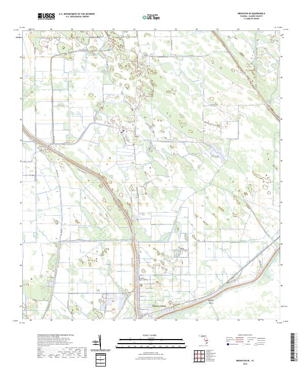
2024 Map of Brighton SE
USGS Topo · Published 2024About this map
Sarasota Colony and Big Bear Beach anchor the southern reaches of this Glades County landscape, where the flatlands meet a heavily managed hydraulic system. The terrain is defined by the rigid geometry of the Harney Pond Canal and Indian Prairie Canal, which cut through the landscape to regulate the flow toward Lake Okeechobee. This network of canals, alongside names like Knotts Lndg and Shell Pit Rd, points to a region historically shaped by water management and extractive industry.
Find a feature on this map
45 named features on this map. Tap any name to fly to it.
Don’t see what you’re looking for? This feature index may not catch every label — zoom into the map to look around manually.
Map Details
Editions of this 2024 Brighton SE Map
This is the sole edition of this map. No revisions or reprints were ever made.
Other maps of this area

1952 · Okeechobee NW
USGS Topo · 1:24,000

1953 · Brighton NW
USGS Topo · 1:24,000

1953 · Brighton SW
USGS Topo · 1:24,000

1953 · Brighton
USGS Topo · 1:24,000

1953 · Brighton SE
USGS Topo · 1:24,000

1953 · Okeechobee SW
USGS Topo · 1:24,000

1956 · West Palm Beach
USGS Topo · 1:250,000

1956 · Fort Pierce
USGS Topo · 1:250,000

1957 · West Palm Beach
USGS Topo · 1:250,000

1958 · Fort Pierce
USGS Topo · 1:250,000