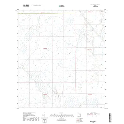
2021 Map of Brighton SW
USGS Topo · Published 2021About this map
Herbert Hoover Dike dominates the southern landscape of this region, a massive engineering feature defining the edge of the wetlands along the Highlands and Glades county line. The terrain is characterized by an intricate network of waterways and marshlands, including the prominent Harney-Pond-Canal that cuts diagonally across the northern sections. This 2021 survey illustrates the managed water systems of south-central Florida, where natural features like Gator Slough coexist with large-scale drainage and flood control projects. These wetlands, including Sixmile Marsh and Cowbone Marsh, represent the complex hydrography of the interior peninsula, showing the balance between the region's agricultural drainage needs and its original marshland character.
Find a feature on this map
6 named features on this map. Tap any name to fly to it.
Don’t see what you’re looking for? This feature index may not catch every label — zoom into the map to look around manually.
Map Details
Editions of this 2021 Brighton SW Map
This is the sole edition of this map. No revisions or reprints were ever made.
Other maps of this area

1953 · Brighton NW
USGS Topo · 1:24,000

1953 · Brighton SW
USGS Topo · 1:24,000

1953 · Brighton
USGS Topo · 1:24,000

1953 · Brighton SE
USGS Topo · 1:24,000

1953 · Childs
USGS Topo · 1:24,000

1956 · West Palm Beach
USGS Topo · 1:250,000

1956 · Fort Pierce
USGS Topo · 1:250,000

1957 · West Palm Beach
USGS Topo · 1:250,000

1957 · Venus
USGS Topo · 1:24,000

1958 · Fort Pierce
USGS Topo · 1:250,000