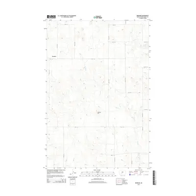
2014 Map of Brisbane
USGS Topo · Published 2014About this map
Brisbane is situated in the high plains of Grant County, where the topography is defined by the prominent Antelope Hills and the winding course of Sixmile Cr. This 2014 survey shows a landscape dominated by a strictly organized grid of agricultural roads, including 51st Ave SW and 74th St SW, which carve the prairie into large sections for ranching and dryland farming. The presence of the Raleigh Reservoir in the northeast corner highlights the critical role of water management in this semi-arid region of North Dakota. For local historians and genealogists, the map provides a clear look at the spatial layout of rural properties and the arterial connections that have sustained this small settlement through the early 21st century.
Find a feature on this map
19 named features on this map. Tap any name to fly to it.
Don’t see what you’re looking for? This feature index may not catch every label — zoom into the map to look around manually.
Map Details
Editions of this 2014 Brisbane Map
This is the sole edition of this map. No revisions or reprints were ever made.
Other maps of this area

1954 · Bismarck
USGS Topo · 1:250,000

1958 · Bismarck
USGS Topo · 1:250,000

1972 · Carson SE
USGS Topo · 1:24,000

1972 · Paradise Flats
USGS Topo · 1:24,000

1980 · Brisbane
USGS Topo · 1:24,000

1980 · Bell Coulee West
USGS Topo · 1:24,000

1980 · Lark
USGS Topo · 1:24,000

1980 · Bell Coulee East
USGS Topo · 1:24,000

1980 · Dogtooth Buttes
USGS Topo · 1:24,000

1980 · Raleigh
USGS Topo · 1:24,000