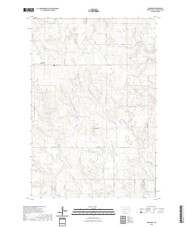
2024 Map of Brisbane
USGS Topo · Published 2024About this map
Brisbane is the focal point of this southwestern North Dakota landscape, situated in the high plains of Grant County. The area is characterized by a grid of rural section-line roads, including 51st Ave SW and 74th St SW, which serve the dispersed farmsteads typical of the region. A significant historical and genealogical landmark, the Holy Infant Cem, stands just east of the settlement, offering a physical record of the community's heritage. The terrain is defined by the Antelope Hills, which rise prominently above the surrounding plains. Drainage for the area is provided by the winding path of Sixmile Creek, which cuts through the township boundaries of t133n r86w and t134n r86w.
Find a feature on this map
25 named features on this map. Tap any name to fly to it.
Don’t see what you’re looking for? This feature index may not catch every label — zoom into the map to look around manually.
Map Details
Editions of this 2024 Brisbane Map
This is the sole edition of this map. No revisions or reprints were ever made.
Other maps of this area

1954 · Bismarck
USGS Topo · 1:250,000

1958 · Bismarck
USGS Topo · 1:250,000

1972 · Carson SE
USGS Topo · 1:24,000

1972 · Paradise Flats
USGS Topo · 1:24,000

1980 · Brisbane
USGS Topo · 1:24,000

1980 · Bell Coulee West
USGS Topo · 1:24,000

1980 · Lark
USGS Topo · 1:24,000

1980 · Bell Coulee East
USGS Topo · 1:24,000

1980 · Dogtooth Buttes
USGS Topo · 1:24,000

1980 · Raleigh
USGS Topo · 1:24,000