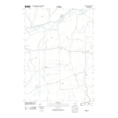
2010 Map of Brisben
USGS Topo · Published 2010About this map
The Chenango River winds through the northern reaches of this landscape, serving as a primary corridor for the village of Brisben. Here, local landmarks like the Brisben Baptist Church and Brisben Cemetery anchor the community's historical footprint. The map documents a predominantly rural and agrarian character, where scattered settlements like Sacketts Harbor and Johnson Corners are connected by a network of local roads that navigate the area's prominent terrain, including Buck Hill and Bobell Hill.
Find a feature on this map
64 named features on this map. Tap any name to fly to it.
Don’t see what you’re looking for? This feature index may not catch every label — zoom into the map to look around manually.
Map Details
Editions of this 2010 Brisben Map
This is the sole edition of this map. No revisions or reprints were ever made.
Other maps of this area

1902 · Coventry
USGS Topo · 1:62,500

1904 · Binghamton
USGS Topo · 1:62,500

1904 · Greene
USGS Topo · 1:62,500

1904 · Oxford
USGS Topo · 1:62,500

1905 · Nineveh
USGS Topo · 1:62,500

1935 · Chenango Forks
USGS Topo · 1:24,000

1942 · Chenango Forks
USGS Topo · 1:31,680
1948 · Greene
USGS Topo · 1:24,000
1948 · Smithville Flats
USGS Topo · 1:24,000

1948 · Binghamton
USGS Topo · 1:250,000