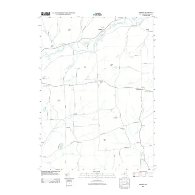
2013 Map of Brisben
USGS Topo · Published 2013About this map
The Chenango River corridor defines this portion of Chenango County, anchoring settlements like Brisben and the historic river crossing at Sacketts Harbor. The landscape is characterized by a series of prominent rises including Harbor Hill, Buck Hill, and Bobell Hill, which separate the river valley from the upland drainage basins of Page Brook and Wylie Brook. This documentation reveals a rural infrastructure built around small communities and family-named landmarks like Shadyside Farm and Johnson Corners.
Find a feature on this map
76 named features on this map. Tap any name to fly to it.
Don’t see what you’re looking for? This feature index may not catch every label — zoom into the map to look around manually.
Map Details
Editions of this 2013 Brisben Map
This is the sole edition of this map. No revisions or reprints were ever made.
Other maps of this area

1902 · Coventry
USGS Topo · 1:62,500

1904 · Binghamton
USGS Topo · 1:62,500

1904 · Greene
USGS Topo · 1:62,500

1904 · Oxford
USGS Topo · 1:62,500

1905 · Nineveh
USGS Topo · 1:62,500

1935 · Chenango Forks
USGS Topo · 1:24,000

1942 · Chenango Forks
USGS Topo · 1:31,680
1948 · Greene
USGS Topo · 1:24,000
1948 · Smithville Flats
USGS Topo · 1:24,000

1948 · Binghamton
USGS Topo · 1:250,000