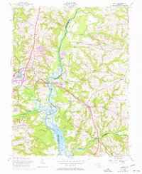
1957 Map of Bristol
USGS Topo · Published 1957About this map
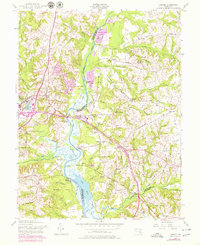
The Patuxent River and its vast marshes dominate this landscape at the intersection of Prince Georges, Anne Arundel, and Calvert Counties. The river acts as a central artery for the region, bordered by a series of historic river landings including Green Landing, Jackson Landing, and Bristol Landing. To the west, the county seat of Upper Marlboro serves as a primary hub, featuring the Penn Central railroad, the Marlboro Sta depot, and the Marlboro Speedway.
Find a feature on this map
75 named features on this map. Tap any name to fly to it.
Don’t see what you’re looking for? This feature index may not catch every label — zoom into the map to look around manually.
Map Details
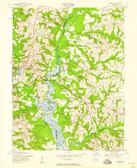
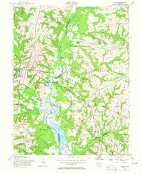
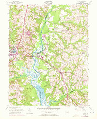
Editions of this 1957 Bristol Map
5 editions found
Other maps of this area

1892 · Prince Frederick
USGS Topo · 1:62,500

1892 · Brandywine
USGS Topo · 1:62,500

1892 · Owensville
USGS Topo · 1:62,500

1895 · Prince Frederick
USGS Topo · 1:62,500

1895 · Brandywine
USGS Topo · 1:62,500

1895 · Owensville
USGS Topo · 1:62,500

1899 · Patuxent
USGS Topo · 1:125,000

1900 · Washington
USGS Topo · 1:62,500

1901 · Prince Frederick
USGS Topo · 1:62,500

1905 · Owensville
USGS Topo · 1:62,500
Featured Places
- Marlboro Meadows, MD
- Upper Marlboro, MD
- Lyons Creek Mobile Estates, MD
- Maryland Manor Trailer Park, MD
- Croom Acres, MD