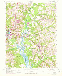
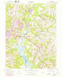
1957 Map of Bristol
USGS Topo · Published 1972About this map
The Patuxent River serves as the central artery of this Maryland landscape, defining the boundary between Prince George's and Anne Arundel counties. Near the marshy expanses of Jug Bay, the terrain is marked by historic river access points like Iron Pot Landing and Jackson Landing, reflecting a long history of water-based transit. Further inland, the town of Upper Marlboro serves as a focal point, where the Penn Central rail line passes by Marlboro Sta and the local Depot.
Find a feature on this map
76 named features on this map. Tap any name to fly to it.
Don’t see what you’re looking for? This feature index may not catch every label — zoom into the map to look around manually.
Map Details
Editions of this 1957 Bristol Map
5 editions found
Other maps of this area

1892 · Prince Frederick
USGS Topo · 1:62,500

1892 · Brandywine
USGS Topo · 1:62,500

1892 · Owensville
USGS Topo · 1:62,500

1895 · Prince Frederick
USGS Topo · 1:62,500

1895 · Brandywine
USGS Topo · 1:62,500

1895 · Owensville
USGS Topo · 1:62,500

1899 · Patuxent
USGS Topo · 1:125,000

1900 · Washington
USGS Topo · 1:62,500

1901 · Prince Frederick
USGS Topo · 1:62,500

1905 · Owensville
USGS Topo · 1:62,500
Featured Places
- Marlboro Meadows, MD
- Upper Marlboro, MD
- Lyons Creek Mobile Estates, MD
- Maryland Manor Trailer Park, MD
- Croom Acres, MD