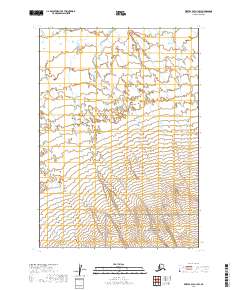
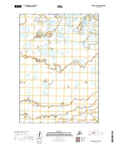
2019 Map of Bristol Bay A-1 SW
USGS Topo · Published 2019About this map
Aniakchak National Monument occupies the southern reaches of this landscape, revealing the transition from high-elevation volcanic terrain to the drainage systems of the Alaska Peninsula. The topography is defined by the winding course of Mud Cr, which meanders through several townships including t35s r56w and t36s r56w. This 2019 survey documents a vast, undeveloped stretch of the Lake and Peninsula Borough where the natural hydrography of the Bristol Bay region remains the primary feature. The map provides precise detail for the numerous small wetlands and unnamed tributaries that feed into the larger creek system, illustrating the complex water drainage patterns essential for the local ecosystem.
Find a feature on this map
8 named features on this map. Tap any name to fly to it.
Don’t see what you’re looking for? This feature index may not catch every label — zoom into the map to look around manually.
Map Details
Editions of this 2019 Bristol Bay A-1 SW Map
This is the sole edition of this map. No revisions or reprints were ever made.
Other maps of this area

1951 · Bristol Bay
USGS Topo · 1:250,000

1963 · Bristol Bay
USGS Topo · 1:250,000
1963 · Bristol Bay A-2
USGS Topo · 1:63,360

1963 · Bristol Bay A-1
USGS Topo · 1:63,360

1963 · Chignik
USGS Topo · 1:250,000

1963 · Chignik D-1
USGS Topo · 1:63,360

1963 · Chignik D-2
USGS Topo · 1:63,360
1967 · Bristol Bay
USGS Topo · 1:250,000
2019 · Bristol Bay A-1 SE
USGS Topo · 1:25,000
2019 · Bristol Bay A-1 NW
USGS Topo · 1:25,000