
1963 Map of Bristol Bay A-1
USGS Topo · Published 1967About this map
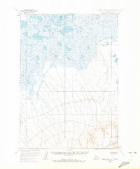
Mud Creek meanders through the northern expanse of this 1963 Alaskan survey, defining a landscape dominated by extensive wetlands and scattered thaw lakes. This segment of the Seward Meridian captures a transitional zone where the saturated lowlands of the north meet the rising elevations of the interior. The topographical data, derived from 1957 aerial photography and field-annotated in the early 1960s, highlights subtle rises such as Alfred and Babs. These named landmarks provide navigational reference points in an otherwise fluid terrain of muskeg and unnamed water bodies. The survey reflects the mapping efforts of the Geological Survey and the Bureau of Land Management, which predetermined unsurveyed land lines across this remote corner of the Bristol Bay quadrangle before extensive ground-level checks.
Find a feature on this map
3 named features on this map. Tap any name to fly to it.
Don’t see what you’re looking for? This feature index may not catch every label — zoom into the map to look around manually.
Map Details
Editions of this 1963 Bristol Bay A-1 Map
2 editions found
Other maps of this area

1943 · Ugashik
USGS Topo · 1:250,000

1948 · Ugashik
USGS Topo · 1:250,000

1949 · Ugashik
USGS Topo · 1:250,000

1951 · Bristol Bay
USGS Topo · 1:250,000

1951 · Sutwik Island
USGS Topo · 1:250,000

1963 · Ugashik B-6
USGS Topo · 1:63,360

1963 · Ugashik A-6
USGS Topo · 1:63,360

1963 · Bristol Bay
USGS Topo · 1:250,000
1963 · Bristol Bay A-2
USGS Topo · 1:63,360

1963 · Sutwik Island
USGS Topo · 1:250,000