
1963 Map of Chignik D-2
USGS Topo · Published 1968About this map
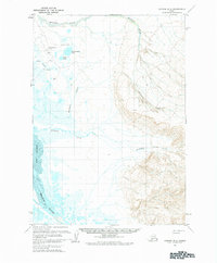
Port Heiden and the winding course of the Meshik River define this coastal landscape on the Alaska Peninsula as it appeared in the early 1960s. The map illustrates a remote environment of low-lying wetlands and complex drainage patterns, where the waters of Birthday Creek, Barabara Creek, and Reindeer Creek converge toward the Bering Sea coast. Significant navigational and aviation infrastructure is concentrated near the shore, notably the Port Heiden Airfield, a Beacon, and Radio Towers. This area, surveyed via aerial photography in 1957 and 1962, also features small bodies of water like Hendrickson Lake and Sven Lake. The eastern portion of the sheet rises toward higher ground, marked by the prominent terrain feature named Witch, contrasting the tidal flats and mud of the river mouth.
Find a feature on this map
14 named features on this map. Tap any name to fly to it.
Don’t see what you’re looking for? This feature index may not catch every label — zoom into the map to look around manually.
Map Details
Editions of this 1963 Chignik D-2 Map
2 editions found
Other maps of this area

1951 · Bristol Bay
USGS Topo · 1:250,000

1963 · Chignik C-3
USGS Topo · 1:63,360

1963 · Chignik C-1
USGS Topo · 1:63,360

1963 · Bristol Bay
USGS Topo · 1:250,000
1963 · Bristol Bay A-2
USGS Topo · 1:63,360

1963 · Chignik D-3
USGS Topo · 1:63,360

1963 · Bristol Bay A-1
USGS Topo · 1:63,360

1963 · Chignik C-2
USGS Topo · 1:63,360

1963 · Chignik
USGS Topo · 1:250,000

1963 · Chignik D-1
USGS Topo · 1:63,360