
1963 Map of Chignik D-3
USGS Topo · Published 1967About this map
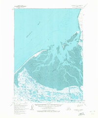
Meshik and its surrounding coastal environment along the northern Alaska Peninsula are documented in this 1963 field survey. The settlement is situated on the eastern shore of Port Heiden, protected from the open waters of Bristol Bay by a complex network of mudflats and shifting shorelines. The landscape is defined by its maritime and freshwater interfaces, where the Meshik River empties into the port and Goldfish Lake sits just inland from the coast.
Find a feature on this map
17 named features on this map. Tap any name to fly to it.
Don’t see what you’re looking for? This feature index may not catch every label — zoom into the map to look around manually.
Map Details
Editions of this 1963 Chignik D-3 Map
2 editions found
Other maps of this area

1951 · Bristol Bay
USGS Topo · 1:250,000

1963 · Chignik C-3
USGS Topo · 1:63,360

1963 · Chignik C-4
USGS Topo · 1:63,360

1963 · Bristol Bay
USGS Topo · 1:250,000
1963 · Bristol Bay A-2
USGS Topo · 1:63,360
1963 · Chignik D-4
USGS Topo · 1:63,360

1963 · Chignik C-2
USGS Topo · 1:63,360

1963 · Chignik
USGS Topo · 1:250,000

1963 · Chignik D-2
USGS Topo · 1:63,360
1967 · Bristol Bay
USGS Topo · 1:250,000