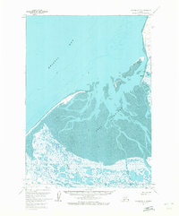
1963 Map of Chignik D-3
USGS Topo · Published 1972About this map
Meshik and its surrounding coastal landscape are defined by the expansive tidal flats of Port Heiden and the open waters of Bristol Bay. This 1963 field-annotated survey reveals a complex network of wetlands and braided streams, including Charles Creek and Yellow Bluff Creek, which feed into the bay across vast areas of mud. The small settlement at Meshik is documented alongside its local cemetery and a nearby gravel pit, indicating the essential infrastructure of this remote shoreline during the early 1960s. Landmarks like the Meshik Az Mark and Heiden NW Base reflect the surveying efforts of the era, while named features such as Chistiakof Island and Strogonof Pt provide navigational context for the surrounding bay.
Find a feature on this map
20 named features on this map. Tap any name to fly to it.
Don’t see what you’re looking for? This feature index may not catch every label — zoom into the map to look around manually.
Map Details
Editions of this 1963 Chignik D-3 Map
2 editions found
Other maps of this area

1951 · Bristol Bay
USGS Topo · 1:250,000

1963 · Chignik C-3
USGS Topo · 1:63,360

1963 · Chignik C-4
USGS Topo · 1:63,360

1963 · Bristol Bay
USGS Topo · 1:250,000
1963 · Bristol Bay A-2
USGS Topo · 1:63,360
1963 · Chignik D-4
USGS Topo · 1:63,360

1963 · Chignik D-3
USGS Topo · 1:63,360

1963 · Chignik C-2
USGS Topo · 1:63,360

1963 · Chignik
USGS Topo · 1:250,000

1963 · Chignik D-2
USGS Topo · 1:63,360