
1963 Map of Chignik C-2
USGS Topo · Published 1967About this map
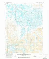
The Meshik River dominates the northern reaches of this Alaskan landscape, weaving through a complex network of wetlands and ponds before entering the mountainous terrain to the south. Near the river's center, Scottys Island provides a point of human activity with the Scottys Island Cabins, representing rare structural development in this expansive wilderness. The topography transitions sharply from the water-heavy lowlands around Highland Creek to the high elevations of the Aleutian Range.
Find a feature on this map
19 named features on this map. Tap any name to fly to it.
Don’t see what you’re looking for? This feature index may not catch every label — zoom into the map to look around manually.
Map Details
Editions of this 1963 Chignik C-2 Map
2 editions found
Other maps of this area

1963 · Chignik B-2
USGS Topo · 1:63,360

1963 · Chignik C-3
USGS Topo · 1:63,360

1963 · Chignik B-1
USGS Topo · 1:63,360

1963 · Chignik C-1
USGS Topo · 1:63,360

1963 · Chignik D-3
USGS Topo · 1:63,360

1963 · Chignik B-3
USGS Topo · 1:63,360

1963 · Chignik
USGS Topo · 1:250,000

1963 · Chignik D-1
USGS Topo · 1:63,360

1963 · Chignik D-2
USGS Topo · 1:63,360
2020 · Chignik B-2 NE
USGS Topo · 1:25,000