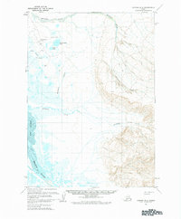
1963 Map of Chignik D-2
USGS Topo · Published 1984About this map
Port Heiden Airfield stands as a focal point of infrastructure on the Alaska Peninsula during this 1963 field-annotated survey. The landscape is defined by the expansive coastal interface of Port Heiden and the winding Meshik River, which drains into the bay from the south. The mapping reveals a network of water bodies such as Hendrickson Lake and Sven Lake, set against a backdrop of complex drainage systems including Barabara Creek and Birthday Creek. Evidence of mid-century technical installations is visible through the presence of a Beacon and Radio Towers near the coast. The terrain transitions from these low-lying marshy areas and gravel pits to the higher elevations marked by the Witch landmark, illustrating the varied geography of the Chignik region before subsequent decades of environmental change.
Find a feature on this map
14 named features on this map. Tap any name to fly to it.
Don’t see what you’re looking for? This feature index may not catch every label — zoom into the map to look around manually.
Map Details
Editions of this 1963 Chignik D-2 Map
2 editions found

Other maps of this area

1951 · Bristol Bay
USGS Topo · 1:250,000

1963 · Chignik C-3
USGS Topo · 1:63,360

1963 · Chignik C-1
USGS Topo · 1:63,360

1963 · Bristol Bay
USGS Topo · 1:250,000
1963 · Bristol Bay A-2
USGS Topo · 1:63,360

1963 · Chignik D-3
USGS Topo · 1:63,360

1963 · Bristol Bay A-1
USGS Topo · 1:63,360

1963 · Chignik C-2
USGS Topo · 1:63,360

1963 · Chignik
USGS Topo · 1:250,000

1963 · Chignik D-1
USGS Topo · 1:63,360