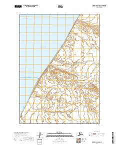
2019 Map of Bristol Bay A-2 SW
USGS Topo · Published 2019About this map
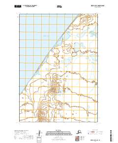
Bristol Bay defines the coastal character of this section of the Alaska Peninsula, where the waters of the Bering Sea meet a low-lying, marshy landscape. The terrain is a complex network of wetlands and small ponds, characteristic of the Lake and Peninsula Borough's maritime fringe. In the southern portion of the quadrangle, Reindeer Cr meanders through the coastal flats, illustrating the typical drainage patterns of this subarctic environment. The lack of named settlements or infrastructure on this modern survey emphasizes the persistent isolation and preservation of the natural shoreline, where land and sea are separated by a porous, shifting boundary of tidal influence and small-scale hydrology.
Find a feature on this map
7 named features on this map. Tap any name to fly to it.
Don’t see what you’re looking for? This feature index may not catch every label — zoom into the map to look around manually.
Map Details
Editions of this 2019 Bristol Bay A-2 SW Map
This is the sole edition of this map. No revisions or reprints were ever made.
Other maps of this area

1951 · Bristol Bay
USGS Topo · 1:250,000

1963 · Bristol Bay
USGS Topo · 1:250,000
1963 · Bristol Bay A-2
USGS Topo · 1:63,360

1963 · Chignik D-3
USGS Topo · 1:63,360

1963 · Chignik
USGS Topo · 1:250,000

1963 · Chignik D-2
USGS Topo · 1:63,360
1967 · Bristol Bay
USGS Topo · 1:250,000
2019 · Bristol Bay A-2 SE
USGS Topo · 1:25,000
2019 · Bristol Bay A-2 NE
USGS Topo · 1:25,000
2019 · Bristol Bay A-2 NW
USGS Topo · 1:25,000