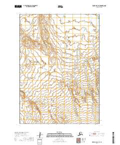
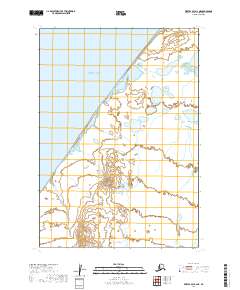
2019 Map of Bristol Bay A-2 SE
USGS Topo · Published 2019About this map
Lake and Peninsula Borough terrain is defined here by intricate wetlands and low-lying water systems, mapped in detail through the Public Land Survey System boundaries including T35s R57w and T36s R57w. This remote stretch of the Alaska Peninsula shows a landscape of unnamed ponds and slow-moving drainage patterns typical of the Bristol Bay region. The absence of named settlements or infrastructure highlights the purely natural state of the land as of the early 21st century. Researchers studying topographical shifts or hydrological changes will find the precise contour intervals and township divisions like T35s R56w and T36s R56w essential for orienting themselves in this undeveloped wilderness.
Find a feature on this map
6 named features on this map. Tap any name to fly to it.
Don’t see what you’re looking for? This feature index may not catch every label — zoom into the map to look around manually.
Map Details
Editions of this 2019 Bristol Bay A-2 SE Map
This is the sole edition of this map. No revisions or reprints were ever made.
Other maps of this area

1951 · Bristol Bay
USGS Topo · 1:250,000

1963 · Bristol Bay
USGS Topo · 1:250,000
1963 · Bristol Bay A-2
USGS Topo · 1:63,360

1963 · Bristol Bay A-1
USGS Topo · 1:63,360

1963 · Chignik
USGS Topo · 1:250,000

1963 · Chignik D-1
USGS Topo · 1:63,360

1963 · Chignik D-2
USGS Topo · 1:63,360
1967 · Bristol Bay
USGS Topo · 1:250,000
2019 · Bristol Bay A-1 NW
USGS Topo · 1:25,000
2019 · Bristol Bay A-2 NE
USGS Topo · 1:25,000