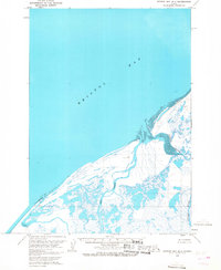
1963 Map of Bristol Bay B-1
USGS Topo · Published 1968About this map
Bristol Bay dominates the northern reaches of this coastal landscape, where the tides shape a complex network of waterways and marshland. The Cinder River and Mud Creek meander through an extensive system of ponds and wetlands, defining a remote environment where small outposts and cabins serve as the primary markers of human presence. Named points such as Edith, Tugg, Roost, and Yoke appear as isolated sites along the interior waterways, likely serving as seasonal camps or navigational landmarks for those traversing the delta. The vast Tidal Flat regions near the river mouths highlight the significant hydrographic changes that occur in this part of the Alaska Peninsula. Compiled from 1962 aerial photography, the map documents a landscape where the boundary between water and land is constantly shifting, providing a clear record of the area's geography before later environmental changes.
Find a feature on this map
11 named features on this map. Tap any name to fly to it.
Don’t see what you’re looking for? This feature index may not catch every label — zoom into the map to look around manually.
Map Details
Editions of this 1963 Bristol Bay B-1 Map
2 editions found
Other maps of this area

1943 · Ugashik
USGS Topo · 1:250,000

1948 · Ugashik
USGS Topo · 1:250,000

1949 · Ugashik
USGS Topo · 1:250,000

1951 · Bristol Bay
USGS Topo · 1:250,000

1951 · Ugashik C-6
USGS Topo · 1:63,360

1963 · Ugashik B-6
USGS Topo · 1:63,360

1963 · Ugashik A-6
USGS Topo · 1:63,360

1963 · Bristol Bay
USGS Topo · 1:250,000
1963 · Bristol Bay A-2
USGS Topo · 1:63,360

1963 · Bristol Bay A-1
USGS Topo · 1:63,360