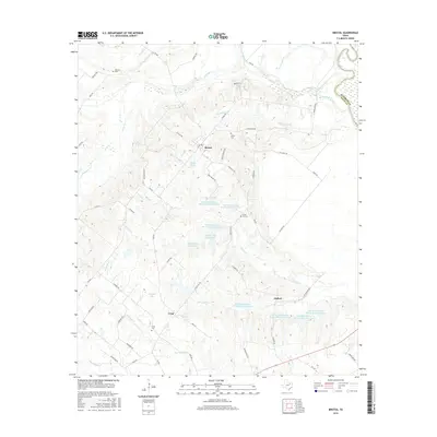
2016 Map of Bristol
USGS Topo · Published 2016About this map
Bristol stands as the central settlement in this eastern Ellis County landscape, situated near the headwaters of Persimmon Br and Bear Cr. The region is defined by a sophisticated water management system, illustrated by numerous numbered reservoirs including Soil Conservation Service Site 3 Reservoir and larger bodies like Hefner Lake Number 1 and Johnson Lake. This 2016 survey captures a rural Texas geography where historic burial sites such as Hefley Cem, Union Hill Cem, and Crisp Cem remain significant landmarks. To the east, the Trinity River marks the boundary with Kaufman County, while the settlements of Alsdorf and Crisp anchor the southern portion of the quadrangle. The road network, including FM 660 and FM 813, connects these communities across a terrain dissected by waterways like Fourmile Cr and Smith Cr.
Find a feature on this map
67 named features on this map. Tap any name to fly to it.
Don’t see what you’re looking for? This feature index may not catch every label — zoom into the map to look around manually.
Map Details
Editions of this 2016 Bristol Map
This is the sole edition of this map. No revisions or reprints were ever made.
Other maps of this area

1891 · Dallas
USGS Topo · 1:125,000

1893 · Dallas
USGS Topo · 1:125,000

1954 · Dallas
USGS Topo · 1:250,000

1956 · Ennis
USGS Topo · 1:62,500

1956 · Kaufman
USGS Topo · 1:62,500

1958 · Dallas
USGS Topo · 1:250,000

1959 · Ferris
USGS Topo · 1:24,000

1959 · India
USGS Topo · 1:24,000

1959 · Seagoville
USGS Topo · 1:62,500

1962 · Ennis West
USGS Topo · 1:24,000