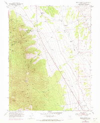
1953 Map of Bristol Range SE
USGS Topo · Published 1971About this map
Mining operations dominate the slopes of the Bristol Range in this mid-century survey of Lincoln County. The landscape is a network of industrial excavations, including the prominent Bristol Silver Mines and Jackrabbit Mines. Prospectors and historians can trace the subterranean reach of these workings through labels like the Jackrabbit Tunnel, Tempest Shaft, and Snyder Shaft, alongside localized sites like the Chinaman Diggings. This concentration of extraction supported local infrastructure, evidenced by the presence of the Bristol School on the western flank of the mountains.
Find a feature on this map
37 named features on this map. Tap any name to fly to it.
Don’t see what you’re looking for? This feature index may not catch every label — zoom into the map to look around manually.
Map Details
Editions of this 1953 Bristol Range SE Map
2 editions found
Other maps of this area

1885 · Pioche
USGS Topo · 1:250,000

1886 · Pioche
USGS Topo · 1:250,000

1915 · Bristol Range
USGS Topo · 1:62,500

1916 · Highland
USGS Topo · 1:62,500

1917 · Bristol Range
USGS Topo · 1:62,500

1918 · Highland
USGS Topo · 1:62,500

1921 · NW 1/4 Panaca
USGS Topo · 1:48,000

1953 · Highland Peak
USGS Topo · 1:24,000

1953 · Bristol Range SE
USGS Topo · 1:24,000

1953 · Pioche
USGS Topo · 1:24,000