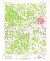
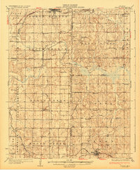
1973 Map of Bristow
USGS Topo · Published 1976About this map
The Shannon Oil Field and surrounding energy tracts define this Oklahoma landscape during a period of industrial maturity. Centered on the city of Bristow, the map reveals a complex infrastructure supporting the region's petroleum and transportation sectors. The Turner Toll Road (Turnpike) and the St Louis-San Francisco railroad cut through the terrain, illustrating the critical transit corridor between Tulsa and Oklahoma City. In the municipal center, civic life is anchored by landmarks like City Hall, the Fairground Armory, and the Po, while educational needs are met by Edison Sch and Washington Sch.
Find a feature on this map
28 named features on this map. Tap any name to fly to it.
Don’t see what you’re looking for? This feature index may not catch every label — zoom into the map to look around manually.
Map Details
Editions of this 1973 Bristow Map
This is the sole edition of this map. No revisions or reprints were ever made.
Other maps of this area

1901 · Nuyaka
USGS Topo · 1:125,000
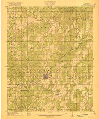
1916 · Bristow
USGS Topo · 1:62,500
1929 · Stroud
USGS Topo · 1:62,500
1931 · Drumright
USGS Topo · 1:62,500
1932 · Stroud
USGS Topo · 1:62,500

1954 · Oklahoma City
USGS Topo · 1:250,000

1957 · Oklahoma City
USGS Topo · 1:250,000

1963 · Oklahoma City
USGS Topo · 1:250,000
1971 · Bellvue
USGS Topo · 1:24,000
1971 · Lake Heyburn
USGS Topo · 1:24,000