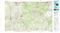
1990 Map of Bristow
USGS Topo · Published 1990About this map
The Cimarron River and Deep Fork define the hydrological character of this central Oklahoma region, where the grid-based settlement pattern of the late 20th century is fully established. Major centers like Bristow, Sapulpa, and Cushing serve as the primary hubs, connected by a network of roads including the Turnpike. This 1990 edition reflects a landscape shaped by both aviation and water management, featuring several landing strips like Cushing Municipal Airport and Stroud Municipal Airport, alongside recreational and utility water bodies such as Heyburn Reservoir and Stroud Lake. Smaller, historic communities including Shamrock, Slick, and Boley are clearly plotted, illustrating the distribution of townships across the borders of Creek, Lincoln, and Okfuskee counties. The presence of the Okmulgee State Wildlife Management Area in the southeast provides a contrast to the surrounding agricultural and urbanized zones.
Find a feature on this map
48 named features on this map. Tap any name to fly to it.
Don’t see what you’re looking for? This feature index may not catch every label — zoom into the map to look around manually.
Map Details
Editions of this 1990 Bristow Map
This is the sole edition of this map. No revisions or reprints were ever made.
Other maps of this area

1893 · Stillwater
USGS Topo · 1:62,500

1896 · Seminole and Prague
USGS Topo · 1:125,000

1896 · Okmulgee
USGS Topo · 1:125,000

1898 · Purcell
USGS Topo · 1:125,000

1900 · Canadian
USGS Topo · 1:125,000

1900 · Wewoka
USGS Topo · 1:125,000

1900 · Okmulgee
USGS Topo · 1:125,000

1901 · Claremore
USGS Topo · 1:125,000

1901 · Nuyaka
USGS Topo · 1:125,000

1905 · Chandler
USGS Topo · 1:62,500