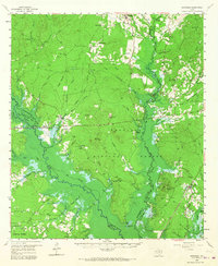
1958 Map of Broaddus
USGS Topo · Published 1967About this map
Angelina National Forest dominates this East Texas landscape, where the confluence of the Attoyac Bayou and the Angelina River defines the drainage patterns. The 1958 field check shows a region of transition, specifically highlighting the proposed McGee Bend Reservoir with blue hachured lines and areas subject to controlled inundation. This mapping reveals the footprint of a landscape about to be permanently altered by dam construction, preserving the locations of numerous family cemeteries and small rural centers like Etoile and Broaddus before the water levels rose.
Find a feature on this map
136 named features on this map. Tap any name to fly to it.
Don’t see what you’re looking for? This feature index may not catch every label — zoom into the map to look around manually.
Map Details
Editions of this 1958 Broaddus Map
3 editions found

Other maps of this area

1931 · Zavalla
USGS Topo · 1:62,500

1932 · Manning
USGS Topo · 1:62,500

1949 · Lufkin
USGS Topo · 1:62,500

1949 · Platt
USGS Topo · 1:24,000

1949 · Huntington
USGS Topo · 1:24,000

1950 · Platt
USGS Topo · 1:24,000

1950 · Huntington
USGS Topo · 1:24,000

1952 · Nacogdoches
USGS Topo · 1:62,500

1953 · Palestine
USGS Topo · 1:250,000

1957 · Palestine
USGS Topo · 1:250,000