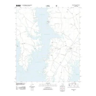
2010 Map of Broaddus
USGS Topo · Published 2010About this map
Sam Rayburn Reservoir dominates this landscape, its expansive waters and intricate shoreline shaping the modern geography of the Angelina River valley. The town of Broaddus sits at a critical junction of several Farm-to-Market roads, including F-M 83 and Farm-to-Market Road 1277, serving as a central hub for the surrounding rural communities. The map reveals a dense network of family-named cemeteries and historical sites that predate the reservoir's creation.
Find a feature on this map
43 named features on this map. Tap any name to fly to it.
Don’t see what you’re looking for? This feature index may not catch every label — zoom into the map to look around manually.
Map Details
Editions of this 2010 Broaddus Map
This is the sole edition of this map. No revisions or reprints were ever made.
Other maps of this area

1931 · Zavalla
USGS Topo · 1:62,500

1953 · Palestine
USGS Topo · 1:250,000

1957 · Palestine
USGS Topo · 1:250,000

1958 · Zavalla
USGS Topo · 1:62,500

1958 · Broaddus
USGS Topo · 1:62,500

1958 · Mc Gee Bend
USGS Topo · 1:62,500

1958 · Bronson
USGS Topo · 1:62,500

1984 · Norwood
USGS Topo · 1:24,000
1984 · Veach
USGS Topo · 1:24,000
1984 · Etoile North
USGS Topo · 1:24,000