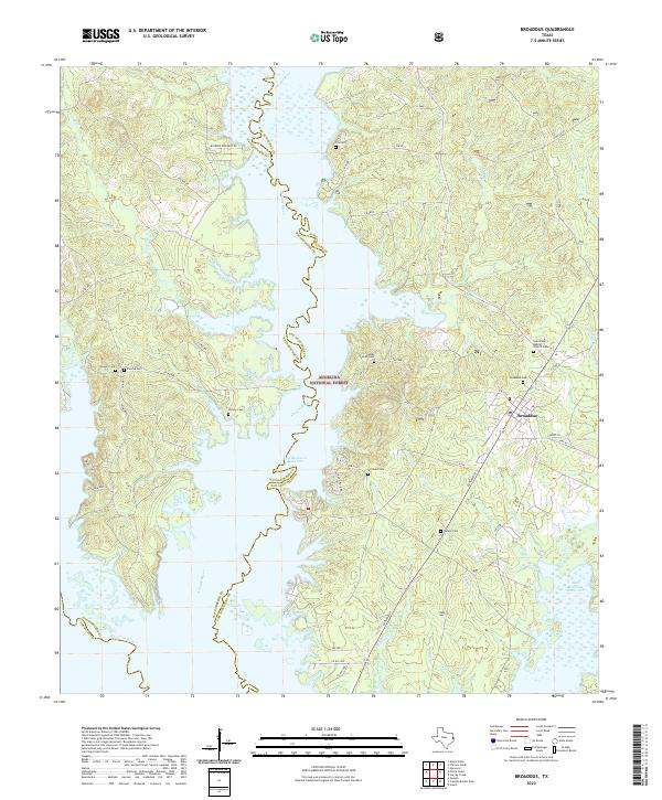
2022 Map of Broaddus
USGS Topo · Published 2022About this map
Angelina National Forest dominates this East Texas landscape, where the Attoyac River and Angelina River converge into the expansive Sam Rayburn Reservoir. The town of Broaddus sits at a critical junction of local transport, situated near the northern reaches of the reservoir. This modern survey illustrates how water management has reshaped the traditional boundaries between San Augustine and Nacogdoches counties. Family history researchers will find a high density of rural burial sites preserved within the forest and along the shoreline, including John Sowell Cem, Williams Cem, and the Saint Peter's Baptist Church Cem. The network of forest roads like Smyrna Rd and Co Rd 489 provides access to these remote points of interest, while numerous named creeks such as Bullet Cr, Owl Cr, and Prairie Cr define the intricate drainage system feeding the central basin.
Find a feature on this map
40 named features on this map. Tap any name to fly to it.
Don’t see what you’re looking for? This feature index may not catch every label — zoom into the map to look around manually.
Map Details
Editions of this 2022 Broaddus Map
This is the sole edition of this map. No revisions or reprints were ever made.
Other maps of this area

1931 · Zavalla
USGS Topo · 1:62,500

1953 · Palestine
USGS Topo · 1:250,000

1957 · Palestine
USGS Topo · 1:250,000

1958 · Zavalla
USGS Topo · 1:62,500

1958 · Broaddus
USGS Topo · 1:62,500

1958 · Mc Gee Bend
USGS Topo · 1:62,500

1958 · Bronson
USGS Topo · 1:62,500

1984 · Norwood
USGS Topo · 1:24,000
1984 · Veach
USGS Topo · 1:24,000
1984 · Etoile North
USGS Topo · 1:24,000