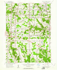
1953 Map of Broadview Heights
USGS Topo · Published 1961About this map
The growing suburban landscape of southern Cuyahoga County is captured here just as the Ohio Turnpike begins to slice through the rural township boundaries. The map centers on Broadview Heights and North Royalton, showing a significant concentration of mid-century communication infrastructure, including the Television Tower (WEWS) and Television Station (WXEL). This technological layer sits atop an older social geography defined by local landmarks like the Wallings Sch, Blossom Hill Sch, and the Veterans Hospital.
Find a feature on this map
44 named features on this map. Tap any name to fly to it.
Don’t see what you’re looking for? This feature index may not catch every label — zoom into the map to look around manually.
Map Details
Editions of this 1953 Broadview Heights Map
2 editions found
Other maps of this area

1902 · Berea
USGS Topo · 1:62,500

1903 · Cleveland
USGS Topo · 1:62,500

1903 · Akron
USGS Topo · 1:62,500

1904 · Berea
USGS Topo · 1:62,500

1904 · Medina
USGS Topo · 1:62,500

1905 · Akron
USGS Topo · 1:62,500

1906 · Medina
USGS Topo · 1:62,500

1950 · Cleveland
USGS Topo · 1:250,000

1953 · Shaker Heights
USGS Topo · 1:24,000

1953 · Broadview Heights
USGS Topo · 1:24,000