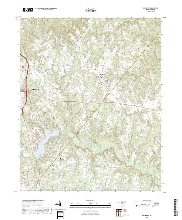
2022 Map of Broadway
USGS Topo · Published 2022About this map
The town of Broadway and the surrounding borderlands of Lee and Harnett Counties are defined by the winding course of the Upper Little River and its varied tributaries. Just north of the town center, Watson Lake and the City Water Works Lake serve as primary water features, while the residential development around Lake Trace highlights modern landscape shifts in the western portion of the quadrangle. The map details a network of rural routes named for early settler families, such as Avents Ferry Rd and Hunter Farm Rd.
Find a feature on this map
144 named features on this map. Tap any name to fly to it.
Don’t see what you’re looking for? This feature index may not catch every label — zoom into the map to look around manually.
Map Details
Editions of this 2022 Broadway Map
This is the sole edition of this map. No revisions or reprints were ever made.
Other maps of this area

1953 · Raleigh
USGS Topo · 1:250,000

1954 · Raleigh
USGS Topo · 1:250,000

1956 · Anderson Creek
USGS Topo · 1:24,000

1957 · Murchisontown
USGS Topo · 1:24,000
1957 · Olivia
USGS Topo · 1:24,000

1970 · Colon
USGS Topo · 1:24,000

1970 · Moncure
USGS Topo · 1:24,000

1974 · Mamers
USGS Topo · 1:24,000
1974 · Cokesbury
USGS Topo · 1:24,000

1974 · Sanford
USGS Topo · 1:24,000