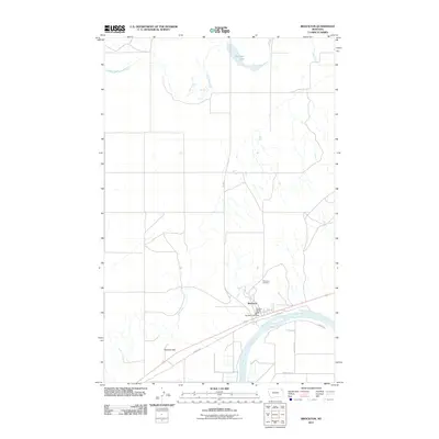
2011 Map of Brockton
USGS Topo · Published 2011About this map
Brockton occupies a strategic position on the northern bank of the Missouri River in this 2011 survey of Roosevelt County. The community serves as a vital hub along the transportation corridor defined by Indian Hwy, where the Brockton Post Office and Brockton Vol Fire Dept remain central landmarks. To the north, the landscape is defined by the winding course of Lake Creek and the waters of McIlwain Lake, reflecting the hydrological character of the high plains. Elevation changes are most notable at Twomile Hill to the west of the town site. For family historians, Riverview Cemetery provides a specific point of interest overlooking the river valley, marking the enduring presence of the community in this northeastern Montana landscape.
Find a feature on this map
13 named features on this map. Tap any name to fly to it.
Don’t see what you’re looking for? This feature index may not catch every label — zoom into the map to look around manually.
Map Details
Editions of this 2011 Brockton Map
This is the sole edition of this map. No revisions or reprints were ever made.
Other maps of this area

1909 · Smoke Creek
USGS Topo · 1:62,500

1912 · Hay Creek
USGS Topo · 1:62,500

1912 · Poplar
USGS Topo · 1:62,500

1912 · Smoke Creek
USGS Topo · 1:62,500

1914 · Brockton
USGS Topo · 1:62,500

1950 · Coyote Coulee
USGS Topo · 1:24,000

1950 · Calais
USGS Topo · 1:24,000

1954 · Wolf Point
USGS Topo · 1:250,000

1958 · Wolf Point
USGS Topo · 1:250,000

1972 · Poplar NE
USGS Topo · 1:24,000
Featured Places
- Brockton, Brockton District
- Brockton District, MT
- Roosevelt County, MT
- Richland County, MT
- United States