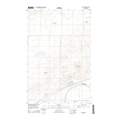
2014 Map of Brockton
USGS Topo · Published 2014About this map
Brockton centers this 2014 survey, situated on the northern bank of the Missouri River where the valley floor transitions into the high plains of Northeast Montana. The landscape is defined by the braided path of the river and the intersecting drainage of Lake Creek, which feeds into the larger waterway just south of the town site. On the bluff overlooking the settlement, the Riverview Cem stands as a local landmark above the primary transportation corridor formed by Us-2 and the adjacent rail lines. To the north, the terrain rises toward Twomile Hill and the seasonal waters of McIlwain Lake. The map details the rural grid of county roads, including CO Road 315 and MT-344, which connect the scattered agricultural lands across the Roosevelt and Richland County boundary.
Find a feature on this map
22 named features on this map. Tap any name to fly to it.
Don’t see what you’re looking for? This feature index may not catch every label — zoom into the map to look around manually.
Map Details
Editions of this 2014 Brockton Map
This is the sole edition of this map. No revisions or reprints were ever made.
Other maps of this area

1909 · Smoke Creek
USGS Topo · 1:62,500

1912 · Hay Creek
USGS Topo · 1:62,500

1912 · Poplar
USGS Topo · 1:62,500

1912 · Smoke Creek
USGS Topo · 1:62,500

1914 · Brockton
USGS Topo · 1:62,500

1950 · Coyote Coulee
USGS Topo · 1:24,000

1950 · Calais
USGS Topo · 1:24,000

1954 · Wolf Point
USGS Topo · 1:250,000

1958 · Wolf Point
USGS Topo · 1:250,000

1972 · Poplar NE
USGS Topo · 1:24,000
Featured Places
- Brockton, Brockton District
- Brockton District, MT
- Roosevelt County, MT
- Richland County, MT
- United States