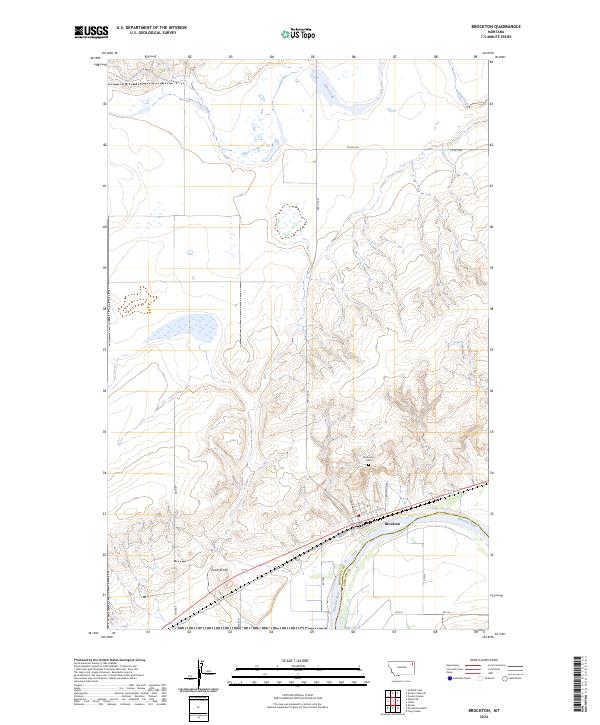
2024 Map of Brockton
USGS Topo · Published 2024About this map
Brockton sits along the northern banks of the Missouri River in this modern survey of the northeastern Montana plains. The town's layout is clearly defined by a network of local streets such as Grandma B Blvd and A Ave, while the surrounding landscape is marked by the significant rise of Twomile Hill to the southwest. North of the primary settlement, the terrain shifts into the drainage basins of Lake Creek, where township lines for t29n r52e and t29n r53e organize the rural landscape. This geography highlights the intersection of river-bottom infrastructure and upland ranching or agricultural divisions. Local history is anchored by the Riverview Cem located near the small settlement of Riverview, while transportation routes like BIA Rte 1 and S Track Rd parallel the river and rail corridor, illustrating the ongoing importance of this transit artery through Roosevelt County.
Find a feature on this map
22 named features on this map. Tap any name to fly to it.
Don’t see what you’re looking for? This feature index may not catch every label — zoom into the map to look around manually.
Map Details
Editions of this 2024 Brockton Map
This is the sole edition of this map. No revisions or reprints were ever made.
Other maps of this area

1909 · Smoke Creek
USGS Topo · 1:62,500

1912 · Hay Creek
USGS Topo · 1:62,500

1912 · Poplar
USGS Topo · 1:62,500

1912 · Smoke Creek
USGS Topo · 1:62,500

1914 · Brockton
USGS Topo · 1:62,500

1950 · Coyote Coulee
USGS Topo · 1:24,000

1950 · Calais
USGS Topo · 1:24,000

1954 · Wolf Point
USGS Topo · 1:250,000

1958 · Wolf Point
USGS Topo · 1:250,000

1972 · Poplar NE
USGS Topo · 1:24,000
Featured Places
- Brockton District, MT
- Brockton, Brockton District
- Roosevelt County, MT
- Richland County, MT
- United States