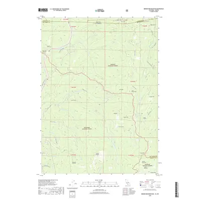
2018 Map of Broken Rib Mountain
USGS Topo · Published 2018About this map
Siskiyou National Forest and Six Rivers National Forest converge at the Oregon-California border, forming a landscape of steep ridgelines and remote alpine waters. This 2018 survey captures the rugged terrain of the Klamath-Siskiyou region, where the Randolph Collier Tunnel carries travelers beneath Hazel View Summit along the modern highway route. The map highlights significant peaks including Broken Rib Mtn, Chicago Peak, and Sanger Peak, which overlook deep drainages like Sanger Canyon.
Find a feature on this map
58 named features on this map. Tap any name to fly to it.
Don’t see what you’re looking for? This feature index may not catch every label — zoom into the map to look around manually.
Map Details
Editions of this 2018 Broken Rib Mountain Map
This is the sole edition of this map. No revisions or reprints were ever made.
Other maps of this area

1917 · Kerby
USGS Topo · 1:125,000

1918 · Kerby
USGS Topo · 1:125,000

1922 · Preston Peak
USGS Topo · 1:125,000

1945 · Kerby
USGS Topo · 1:125,000

1945 · Gasquet
USGS Topo · 1:62,500

1948 · Weed
USGS Topo · 1:250,000

1950 · Weed
USGS Topo · 1:250,000

1951 · Gasquet
USGS Topo · 1:62,500

1954 · Cave Junction
USGS Topo · 1:62,500

1954 · Chetco Peak
USGS Topo · 1:62,500