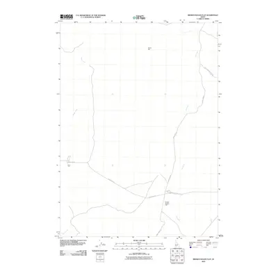
2010 Map of Broken Wagon Flat
USGS Topo · Published 2010About this map
Broken Wagon Flat defines the open Owyhee County landscape, where early 21st-century surveys reveal a sparse network of roads crossing high desert terrain. The presence of Missile Base Rd hints at the cold-war era military infrastructure that once occupied these stretches of southwestern Idaho, intersecting with routes like Sheep Creek Rd and Broken Wagon Flat Rd. Water sources remain critical landmarks in this arid environment, with drainage provided by Hot Creek and Sugar Creek. Notable land features like Horse Hill and the uniquely named Horse Trap suggest the area's history with livestock and wild horses, providing specific points of interest for researchers tracing the historical use of public lands in the region.
Find a feature on this map
10 named features on this map. Tap any name to fly to it.
Don’t see what you’re looking for? This feature index may not catch every label — zoom into the map to look around manually.
Map Details
Editions of this 2010 Broken Wagon Flat Map
This is the sole edition of this map. No revisions or reprints were ever made.
Other maps of this area

1947 · Little Valley
USGS Topo · 1:24,000

1947 · Bruneau
USGS Topo · 1:62,500

1947 · Sugar Valley
USGS Topo · 1:24,000

1947 · Hot Spring
USGS Topo · 1:24,000
1948 · Little Valley
USGS Topo · 1:24,000

1948 · Sugar Valley
USGS Topo · 1:24,000

1948 · Indian Cove
USGS Topo · 1:62,500
1949 · Hot Spring
USGS Topo · 1:24,000

1955 · Twin Falls
USGS Topo · 1:250,000

1956 · Big Hill
USGS Topo · 1:62,500