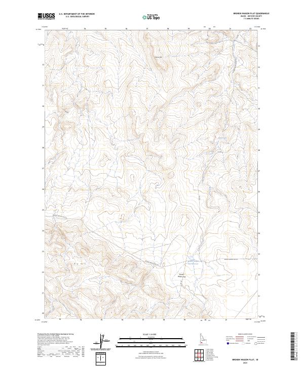
2023 Map of Broken Wagon Flat
USGS Topo · Published 2023About this map
Horse Hill and Big Hill dominate this high-desert portion of Owyhee County, where the landscape is defined by drainage patterns and remote rangeland infrastructure. In the early 21st century, this area remains characterized by its limited water sources, such as Broken Wagon Flat Reservoir, Deer Water, and the seasonal flows of Sugar Creek and Hot Creek. The settlement pattern is sparse, centered on the eponymous Broken Wagon Flat. Transportation through this arid terrain relies on a network of functional dirt routes, including the historic Broken Wagon Trail Rd and the CCC Rd, reflecting the enduring influence of early 20th-century public works and cattle-driving paths on the modern map. The township and range lines of t8s r5e and t9s r6e provide a geometric contrast to the winding creek beds and irregular contours of the hills.
Find a feature on this map
15 named features on this map. Tap any name to fly to it.
Don’t see what you’re looking for? This feature index may not catch every label — zoom into the map to look around manually.
Map Details
Editions of this 2023 Broken Wagon Flat Map
This is the sole edition of this map. No revisions or reprints were ever made.
Other maps of this area

1947 · Little Valley
USGS Topo · 1:24,000

1947 · Bruneau
USGS Topo · 1:62,500

1947 · Sugar Valley
USGS Topo · 1:24,000

1947 · Hot Spring
USGS Topo · 1:24,000
1948 · Little Valley
USGS Topo · 1:24,000

1948 · Sugar Valley
USGS Topo · 1:24,000

1948 · Indian Cove
USGS Topo · 1:62,500
1949 · Hot Spring
USGS Topo · 1:24,000

1955 · Twin Falls
USGS Topo · 1:250,000

1956 · Big Hill
USGS Topo · 1:62,500