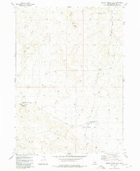
1980 Map of Broken Wagon Flat
USGS Topo · Published 1980About this map
Missile Base and the associated Missile Base Road highlight a Cold War military presence in this high-desert portion of Owyhee County. The landscape is defined by vast, open grazing lands and water management features essential for range life, such as the Broken Wagon Flat Reservoir and a Horse Trap (Corral). Located between the elevations of Big Hill and Horse Hill, the area shows a network of remote infrastructure including the CCC Road and several gravel pits, indicating both mid-century public works projects and local resource extraction. Water sources are scarce, marked by drainage systems like Sugar Creek and Hot Creek, as well as the notable Windy Well (Dry). The map reflects a working landscape where ranching, transit via the Blackstone Road, and national defense interests converged in the late 20th century.
Find a feature on this map
18 named features on this map. Tap any name to fly to it.
Don’t see what you’re looking for? This feature index may not catch every label — zoom into the map to look around manually.
Map Details
Editions of this 1980 Broken Wagon Flat Map
This is the sole edition of this map. No revisions or reprints were ever made.
Other maps of this area

1947 · Little Valley
USGS Topo · 1:24,000

1947 · Bruneau
USGS Topo · 1:62,500

1947 · Sugar Valley
USGS Topo · 1:24,000

1947 · Hot Spring
USGS Topo · 1:24,000
1948 · Little Valley
USGS Topo · 1:24,000

1948 · Sugar Valley
USGS Topo · 1:24,000

1948 · Indian Cove
USGS Topo · 1:62,500
1949 · Hot Spring
USGS Topo · 1:24,000

1955 · Twin Falls
USGS Topo · 1:250,000

1956 · Big Hill
USGS Topo · 1:62,500