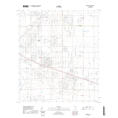
2018 Map of Bronson NE
USGS Topo · Published 2018About this map
The boundary between Alachua and Levy counties cuts through this north Florida landscape, which is defined by its karst topography and scattered rural settlements. Small communities like Merediths and East Bronson anchor a grid of local roads, while Spring Hill sits further south near a series of distinctive water bodies. The terrain is dotted with notable depressions and ponds, including the eponymous Cherry Sink and the larger Sawgrass Lake. These features, along with German Pond and Marshall Pond, reflect the complex hydrology of the region. Local history is anchored by the Smith Cem in the southwestern quadrant, providing a touchstone for genealogical research in this quiet part of the state. The layout of the land shows a transition from structured residential blocks in the west to more open, pond-filled terrain as one moves east toward the county line.
Find a feature on this map
112 named features on this map. Tap any name to fly to it.
Don’t see what you’re looking for? This feature index may not catch every label — zoom into the map to look around manually.
Map Details
Editions of this 2018 Bronson NE Map
This is the sole edition of this map. No revisions or reprints were ever made.
Other maps of this area

1890 · Arredondo
USGS Topo · 1:62,500

1892 · Arredondo
USGS Topo · 1:62,500

1894 · Arredondo
USGS Topo · 1:62,500

1895 · Williston
USGS Topo · 1:62,500

1954 · Bronson
USGS Topo · 1:24,000

1954 · Bronson SW
USGS Topo · 1:24,000

1954 · Gainesville
USGS Topo · 1:250,000

1955 · Bronson NE
USGS Topo · 1:24,000

1955 · Bronson SE
USGS Topo · 1:24,000
1957 · Bronson SE
USGS Topo · 1:25,000