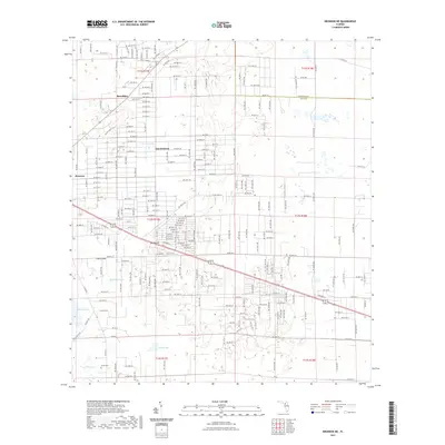
2021 Map of Bronson NE
USGS Topo · Published 2021About this map
The boundary between Alachua Co and Levy Co runs through the northern portion of this landscape, where the flatwoods are punctuated by numerous karst features and shallow basins. Settlements such as Merediths and East Bronson are defined by a grid of local roads and county routes that navigate around topographical depressions like German Pond and the karst-formed Cherry Sink. The area reflects a rural residential and agricultural pattern, with larger clusters of development concentrated near Bronson at the western edge of the sheet.
Find a feature on this map
25 named features on this map. Tap any name to fly to it.
Don’t see what you’re looking for? This feature index may not catch every label — zoom into the map to look around manually.
Map Details
Editions of this 2021 Bronson NE Map
This is the sole edition of this map. No revisions or reprints were ever made.
Other maps of this area

1890 · Arredondo
USGS Topo · 1:62,500

1892 · Arredondo
USGS Topo · 1:62,500

1894 · Arredondo
USGS Topo · 1:62,500

1895 · Williston
USGS Topo · 1:62,500

1954 · Bronson
USGS Topo · 1:24,000

1954 · Bronson SW
USGS Topo · 1:24,000

1954 · Gainesville
USGS Topo · 1:250,000

1955 · Bronson NE
USGS Topo · 1:24,000

1955 · Bronson SE
USGS Topo · 1:24,000
1957 · Bronson SE
USGS Topo · 1:25,000