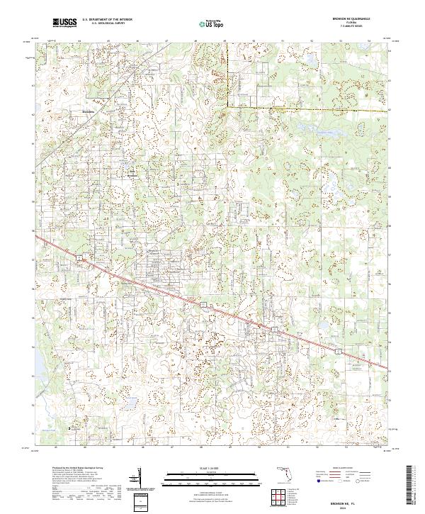
2024 Map of Bronson NE
USGS Topo · Published 2024About this map
Spring Hill and East Bronson anchor this section of Levy County, where a grid of rural residential roads meets a landscape defined by seasonal water and limestone sink features. The area's karst topography is evident in landmarks like Cherry Sink, while larger bodies of water such as Marshall Pond and Sawgrass Lake suggest the low-lying, poorly drained nature of the Florida interior. The transition between Alachua and Levy counties is visible along the northern boundary, marking a divide in local jurisdictions.
Find a feature on this map
116 named features on this map. Tap any name to fly to it.
Don’t see what you’re looking for? This feature index may not catch every label — zoom into the map to look around manually.
Map Details
Editions of this 2024 Bronson NE Map
This is the sole edition of this map. No revisions or reprints were ever made.
Other maps of this area

1890 · Arredondo
USGS Topo · 1:62,500

1892 · Arredondo
USGS Topo · 1:62,500

1894 · Arredondo
USGS Topo · 1:62,500

1895 · Williston
USGS Topo · 1:62,500

1954 · Bronson
USGS Topo · 1:24,000

1954 · Bronson SW
USGS Topo · 1:24,000

1954 · Gainesville
USGS Topo · 1:250,000

1955 · Bronson NE
USGS Topo · 1:24,000

1955 · Bronson SE
USGS Topo · 1:24,000
1957 · Bronson SE
USGS Topo · 1:25,000