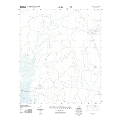
2010 Map of Bronson
USGS Topo · Published 2010About this map
Bronson stands at the northeast corner of this San Augustine County landscape, where the local road network centers on the junction of FM-1 and Little Flock Rd. The western portion of the terrain is defined by the expansive Sam Rayburn Reservoir, which has altered the original path of Chiamon Bayou and several smaller tributaries like Bobbitt Creek. This 2010 survey illustrates the transition from the lakeside residential developments of Glen Oaks and Anthony Harbor to the rural timberlands and scattered family settlements found further inland.
Find a feature on this map
37 named features on this map. Tap any name to fly to it.
Don’t see what you’re looking for? This feature index may not catch every label — zoom into the map to look around manually.
Map Details
Editions of this 2010 Bronson Map
This is the sole edition of this map. No revisions or reprints were ever made.
Other maps of this area

1953 · Alexandria
USGS Topo · 1:250,000

1953 · Palestine
USGS Topo · 1:250,000

1955 · Alexandria
USGS Topo · 1:250,000

1957 · Palestine
USGS Topo · 1:250,000

1957 · Brookeland
USGS Topo · 1:62,500

1958 · Hemphill
USGS Topo · 1:62,500

1958 · Mc Gee Bend
USGS Topo · 1:62,500

1958 · Bronson
USGS Topo · 1:62,500

1969 · Brookeland
USGS Topo · 1:62,500

1984 · Norwood
USGS Topo · 1:24,000