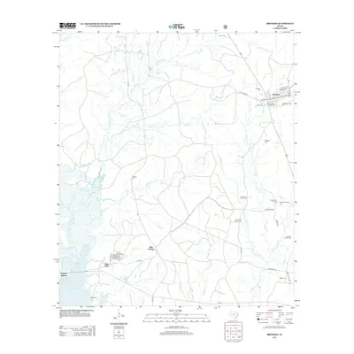
2013 Map of Bronson
USGS Topo · Published 2013About this map
Bronson stands as a focal point in this portion of San Augustine County, where the street grid including De Rugely St and McHenry St meets the rural landscape. The map reveals a dense network of family history through its numerous small burial grounds, such as the Beauchamp Family Cem and the McClelland Family Cem. To the southwest, the terrain transitions into the waters of the Sam Rayburn Reservoir, where Anthony Harbor and the residential development of Glen Oaks define the modern shoreline. The interior is defined by a complex drainage system where Chiamon Bayou and Jack Williams Cr navigate a landscape of timber and rural homesteads. This 2013 survey provides a clear view of how established settlements like Blue Springs and local landmarks like the Old Centerview Cem persist alongside contemporary infrastructure.
Find a feature on this map
56 named features on this map. Tap any name to fly to it.
Don’t see what you’re looking for? This feature index may not catch every label — zoom into the map to look around manually.
Map Details
Editions of this 2013 Bronson Map
This is the sole edition of this map. No revisions or reprints were ever made.
Other maps of this area

1953 · Alexandria
USGS Topo · 1:250,000

1953 · Palestine
USGS Topo · 1:250,000

1955 · Alexandria
USGS Topo · 1:250,000

1957 · Palestine
USGS Topo · 1:250,000

1957 · Brookeland
USGS Topo · 1:62,500

1958 · Hemphill
USGS Topo · 1:62,500

1958 · Mc Gee Bend
USGS Topo · 1:62,500

1958 · Bronson
USGS Topo · 1:62,500

1969 · Brookeland
USGS Topo · 1:62,500

1984 · Norwood
USGS Topo · 1:24,000